天地图API绘制的图形进行编辑修改
请教如何对绘制的多边形进行编辑,就是可以移动顶点坐标,对图形的外观进行编辑。多边形采用《PolygonTool》工具箱绘制,并不是采用预先给定坐标,然后采用 map.addOverLay(line)方式绘制。源代码如下,可正常运行,但就是不能编辑多边形。
<!DOCTYPE html>
<html>
<head>
    <meta http-equiv="content-type" content="text/html; charset=utf-8"/>
    <meta name="keywords" content="天地图"/>
    <title>天地图-地图API-范例-画线</title>
    <script type="text/javascript" src="http://api.tianditu.gov.cn/api?v=4.0&tk=秘匙"></script>
    <style type="text/css">body,html{width:100%;height:100%;margin:0;font-family:"Microsoft YaHei"}#mapDiv{width:100%;height:400px}input,b,p{margin-left:5px;font-size:14px}</style>
    <script>
        var map;
        var zoom = 12;
        var handler;
        function onLoad() {
            //初始化地图对象
            map = new T.Map("mapDiv");
            //设置显示地图的中心点和级别
            map.centerAndZoom(new T.LngLat(116.40969, 39.94940), zoom);
            var config = {
                showLabel: true,
                color: "blue", weight: 3, opacity: 0.5, fillColor: "#FFFFFF", fillOpacity: 0.5
            };
            //创建标注工具对象
            polygonTool = new T.PolygonTool(map, config);
          }
            function openPolygonTool() {
              if (handler) handler.close();
               handler = new T.PolygonTool(map);
               handler.isEditable=true;
               handler.open();
        }
    </script>
</head>
<body onLoad="onLoad()">

<div  id="mapDiv" ></div>
<p>本示例演示如何启动和禁止线的编辑功能。</p>
<div >
    <input type="button" value="绘制多边形" onclick="openPolygonTool();"/>
    <input type="button" value="启动编辑" onclick="line.enableEdit();">
    <input type="button" value="禁止编辑" onclick="line.disableEdit();"/>
</div>
</body>
</html>
想要的效果如下图所示:

前面的答题者说了,可以使用line.enableEdit();line.disableEdit();来控制是否编辑,如果不行的话,那说明PolygonTool不一定带有编辑功能,具体你需要查看下官方的API,看下是否支持该图像的编辑功能,如果不支持的话,那你可能需要更换实现方案。
我现在把我的全部代码贴出来,方便大家寻找问题。注意:key除外。
<!DOCTYPE html>
<html>
<head>
    <meta charset="UTF-8"/>
    <title>在线天地图服务</title>
    <script type="text/javascript" src="https://api.tianditu.gov.cn/api?v=4.0&tk=略"></script>
    <script type="text/javascript" src="jsscty.js"></script>
    <link href="tstyle.css" rel="stylesheet" type="text/css" />
    <script type="text/javascript">
       function thide() {
           var traget=document.getElementById("tool");
               traget.style.display="none";
       }

    </script>
    <script type="text/javascript">
       function tdisplay() {
           var traget=document.getElementById("tool");
               traget.style.display="";
       }

    </script>
</head>
<body onLoad="onLoad()">
<div class="edt">
    <input type="button" value="<>"    onClick='tdisplay()' class="but" />
    <li></li>
    <input type="button" value="><"    onClick='thide()' class="but" />
</div>
<div class="input" id="tool">
    <input type="button" value="地图标注"    onClick='openMarkerTool() ' class="button" />
    <li></li>
    <input type="button" value="绘制直线"  onClick='openPolylineTool() ' class="button"/>
</div>
<!--地图容器-->
<div id="mapDiv" class="mapDiv"></div>
</body>
</html>
后面是JS代码部分:
     var control;
     var map, zoom = 12,handler;
     var line = [];
        function onLoad() {
            map = new T.Map('mapDiv',{
                 minZoom:3,
                 maxZoom:18
                      });
            map.centerAndZoom(new T.LngLat(116.40769, 39.89945), zoom);
            var lc = new T.LocalCity();
            lc.location(function (e) {
                var marker = new T.Marker(e.lnglat);
                map.addOverLay(marker);
            });
            //创建缩放平移控件对象
            control = new T.Control.Zoom();
            //添加缩放平移控件
            map.addControl(control);
            //允许鼠标滚轮缩放地图
            map.enableScrollWheelZoom();
            //创建比例尺控件对象
            var scale = new T.Control.Scale();
            //添加比例尺控件
            map.addControl(scale);
            //创建地图类型对象
            var ctrl = new T.Control.MapType();
            //添加控件
            map.addControl(ctrl);
            var config = {
                showLabel: true,
                color: "blue", weight: 3, opacity: 0.5, fillColor: "#FFFFFF", fillOpacity: 0.5
              };
            //创建标注工具对象
            polygonTool = new T.PolygonTool(map, config);

            //创建右键菜单
            var menu = new T.ContextMenu({
                width: 100
            });
            var txtMenuItem = [
               {
                    text: '设为标记点',
                    callback: function () {
                        map.zoomIn()
                    }
                },
                {
                    text: '编辑图形',
                    callback: function () {
                        //此处需增加编辑图形的函数的请教问题
                        //官网案例是通过按钮的onclick事件实现编辑,我是想通过右键直接编辑。
                    }
                },
            ];

               for (var i = 0; i < txtMenuItem.length; i++) {
                   //添加菜单项
                   var menuItem = new T.MenuItem(txtMenuItem[i].text, txtMenuItem[i].callback);
                   menu.addItem(menuItem);
                   if (i == 1) {
                       //添加分割线
                       menu.addSeparator();
                   }
               }
               //添加右键菜单
               map.addContextMenu(menu);
        }

           //绘制直线

           function openPolylineTool() {
              if (handler) handler.close();
              handler = new T.PolylineTool(map);
              handler.open();

          }

         //绘制一个点

           function openMarkerTool() {
              if (handler) handler.close();
              handler = new T.MarkTool(map, {follow: true});
              handler.open();
          }
你说的挺凌乱的。
如果只是编辑:line.enableEdit();line.disableEdit();
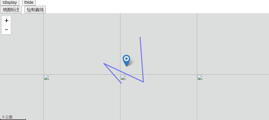
vue【天地图】使用天地图api绘制GeoJson解析,矩形绘画,实现本地js天地图效果
<template>
  <div >
      <div class="Map_conter" id="map"></div>
      <div class="Draw_draw__pv">
          <el-tooltip class="item" effect="dark" content="测距" placement="left">
            <div class="point" @click="lineTool.open()">
                <img src="../assets/images/lineTool.png" class="pointImg">
            </div>
        </el-tooltip>
        <el-tooltip class="item" effect="dark" content="测面" placement="left">
             <div class="point" @click="polygonTool.open()">
                <img src="../assets/images/polygonTool.png" class="pointImg2">
            </div>
        </el-tooltip>
    </div>
  </div>
</template>

<script>
export default {
  data () {
        return {
            map: {},//地图
            infoWin: '',
            lineTool: '',//测距工具
            polygonTool: '',//测面工具

    };
  },

  created() {},

    methods: {
    handleAddPoint(id) {
      this.ID = id
      pubOne(this.ID).then(res => {
        this.pubOneData = res.data
        if (this.pubOneData.GEOJSON == null || this.pubOneData.GEOJSON == '') {
          this.$message({ type: 'success', message: '定位不到相关位置!', })
          this.clearAll();
        } else {
          this.getLinesFromGeojson(this.pubOneData.GEOJSON,this.pubOneData.name) //服务器返回GEOJSON数据传
        }
      })
    },
    /**
     * 从GEOJSON获取所有linestring
     * @param {*} GEOJSON
     * @returns  返回线段数组
     */
    getLinesFromGeojson(GEOJSON, name) {
      var json = JSON.parse(GEOJSON);
      let lines = [];
      let _bounds = [];
      let points = [];
      let geometries = json.geometry.coordinates[0];
      for (let i = 0; i < geometries.length; i++) {
        lines.push(geometries[i])
      }
      lines.forEach((coors) => {
        let polygon = this.createPolygon(coors, {
          fillOpacity: 0.001
        });
        this.map.addOverLay(polygon);

        if (this.infoWin) {
          this.map.removeOverLay(this.infoWin);
          this.infoWin = null;
        }
        var html = "<h5>" + name + "</h5>";
        this.infoWin = new T.InfoWindow(html, new T.Point([0, 0]));
        polygon.openInfoWindow(this.infoWin);

        polygon.addEventListener("click", function () {
          this.isShowDetails = true
        }, this);

        //设置中心点
        let _Bounds = polygon.getBounds();//拿到对象范围
        _bounds = _Bounds.getCenter();//获取中心点
        geometries.forEach((lonlat) => {
          points.push(new T.LngLat(lonlat[0], lonlat[1]));
        })
        this.map.setViewport(points); //设置范围
      })
      this.map.centerAndZoom(new T.LngLat(_bounds.lng, _bounds.lat), 10);
      return lines
    },

    /**
     * 创建polygon
     * @param {*} points 多边形坐标 二维数组
     * @param {*} option
     * @returns  返回polygon
     */
    createPolygon(coors, option){
      let points = [];
      coors.forEach((lonlat) => {
        points.push(new T.LngLat(lonlat[0], lonlat[1]));
      })
      this.clearAll();
      let polygon = new T.Polygon(points, {
        color: "#167FFD", weight: 2, opacity: 1, fillColor: "#167FFD", fillOpacity: 0.5
      });
      return polygon
    },
    //清空地图及搜索列表
    clearAll() {
      this.map.clearOverLays();
      this.map.centerAndZoom(new T.LngLat(112.944895, 28.236163), 12);
    },
    load() {
      var T = window.T;
      var imageURL = 'http://t0.tianditu.gov.cn/img_c/wmts?tk=你申请的key';
      var lay = new T.TileLayer(imageURL, { minZoom: 1, maxZoom: 18 });
      var config = { layers: [lay], name: 'TMAP_SATELLITE_MAP' };

      this.map = new T.Map('map', config); // 地图实例

      var ctrl = new T.Control.MapType();
      this.map.addControl(ctrl);
      this.map.setMapType(window.TMAP_HYBRID_MAP);   // 设置地图位地星混合图层

      this.map.centerAndZoom(new T.LngLat(112.944895, 28.236163), 12);
      //允许鼠标双击放大地图
      this.map.enableScrollWheelZoom();
      this.map.enableDrag();
      //创建比例尺控件对象 添加比例尺控件
      var scale = new T.Control.Scale();
      this.map.addControl(scale);

      var config = {
        showLabel: true,
        color: "red", weight: 3, opacity: 0.5, fillColor: "#FFFFFF", fillOpacity: 0.5
      };
      //创建标注工具对象
      this.lineTool = new T.PolylineTool(this.map, config);
      //创建标注工具对象
      this.polygonTool = new T.PolygonTool(this.map, config);
      this.GetMaps()
    },
    GetMaps() {
      let T = window.T;
      //设置显示地图的中心点和级别
      this.map.clearOverLays();
      this.map.centerAndZoom(new T.LngLat(111.52232, 25.116313), 9);
      var icon = new T.Icon({
        iconUrl: 'http://api.tianditu.gov.cn/img/map/markerA.png',
        iconSize: new T.Point(33, 33),
        iconAnchor: new T.Point(10, 25)
      });
      var latlng = new T.LngLat(21, 22,); // 设置坐标点传入经度纬度
      let marker = new T.Marker(latlng, { icon: icon });// 创建标注

    },

    },
    mounted() {
        this.load();
    }
}
</script>

<style lang='less' scoped>
.Map_conter {
    position: relative;
    width: 100%;
    height: 800px;
    overflow: hidden;
    z-index: 3;
}
</style>
根据你提供的代码,你使用了天地图API绘制了一个多边形,并希望能够对多边形进行编辑,包括移动顶点坐标和修改外观。
在你的代码中,你创建了一个T.PolygonTool对象,并将其赋值给handler变量。但是,在openPolygonTool函数中,你没有正确使用handler对象来启动多边形的编辑功能。
以下是修改后的代码示例,演示如何启用和禁用多边形的编辑功能:
<!DOCTYPE html>
<html>
<head>
    <meta http-equiv="content-type" content="text/html; charset=utf-8"/>
    <meta name="keywords" content="天地图"/>
    <title>天地图-地图API-范例-画线</title>
    <script type="text/javascript" src="http://api.tianditu.gov.cn/api?v=4.0&tk=秘匙"></script>
    <style type="text/css">body,html{width:100%;height:100%;margin:0;font-family:"Microsoft YaHei"}#mapDiv{width:100%;height:400px}input,b,p{margin-left:5px;font-size:14px}</style>
    <script>
        var map;
        var zoom = 12;
        var polygonTool;

        function onLoad() {
            //初始化地图对象
            map = new T.Map("mapDiv");
            //设置显示地图的中心点和级别
            map.centerAndZoom(new T.LngLat(116.40969, 39.94940), zoom);
            var config = {
                showLabel: true,
                color: "blue", weight: 3, opacity: 0.5, fillColor: "#FFFFFF", fillOpacity: 0.5
            };
            //创建标注工具对象
            polygonTool = new T.PolygonTool(map, config);
        }

        function openPolygonTool() {
            polygonTool.open();
        }

        function enableEdit() {
            polygonTool.enableEdit();
        }

        function disableEdit() {
            polygonTool.disableEdit();
        }
    </script>
</head>
<body onLoad="onLoad()">

<div id="mapDiv"></div>
<p>本示例演示如何启动和禁止线的编辑功能。</p>
<div>
    <input type="button" value="绘制多边形" onclick="openPolygonTool();"/>
    <input type="button" value="启动编辑" onclick="enableEdit();">
    <input type="button" value="禁止编辑" onclick="disableEdit();"/>
</div>
</body>
</html>
在修改后的代码中,我将handler变量改为polygonTool,并将其作为全局变量。在openPolygonTool函数中,直接调用polygonTool的open方法来启动多边形的绘制功能。在enableEdit和disableEdit函数中,分别调用polygonTool的enableEdit和disableEdit方法来启用和禁用多边形的编辑功能。
请注意,以上代码修改仅供参考,具体的实现方式可能因你使用的地图API版本和配置而有所不同。你可以根据天地图API的文档和示例进行进一步的调整和扩展。希望这能帮助到你!