openLayers 判断4326 和 3857
请问大家知道有什么方法可以判断投影是4326还是3857,拿到一个数据之后进行判断。
使用OpenLayers库可以判断4326和3857投影的方法:
首先要确定数据的投影信息。
然后,使用OpenLayers库的ol.proj.get(<投影代码>)函数可以获得投影的相关信息,投影代码分别是'EPSG:4326'和'EPSG:3857'。
如果获得的投影信息是'EPSG:4326',则代表数据使用的是4326投影。如果是'EPSG:3857',则代表数据使用的是3857投影。
var projectionCode = 'EPSG:4326';
var projection = ol.proj.get(projectionCode);
if(projection) {
  console.log("The projection is: " + projectionCode);
}
else {
  console.log("Invalid projection code: " + projectionCode);
}
- 建议你看下这篇博客👉 :Openlayer加载4326、3857坐标系的矢量切片服务
- 除此之外, 这篇博客: Openlayer加载4326、3857坐标系的矢量切片服务中的 EPSG:4326坐标系 部分也许能够解决你的问题, 你可以仔细阅读以下内容或者直接跳转源博客中阅读:
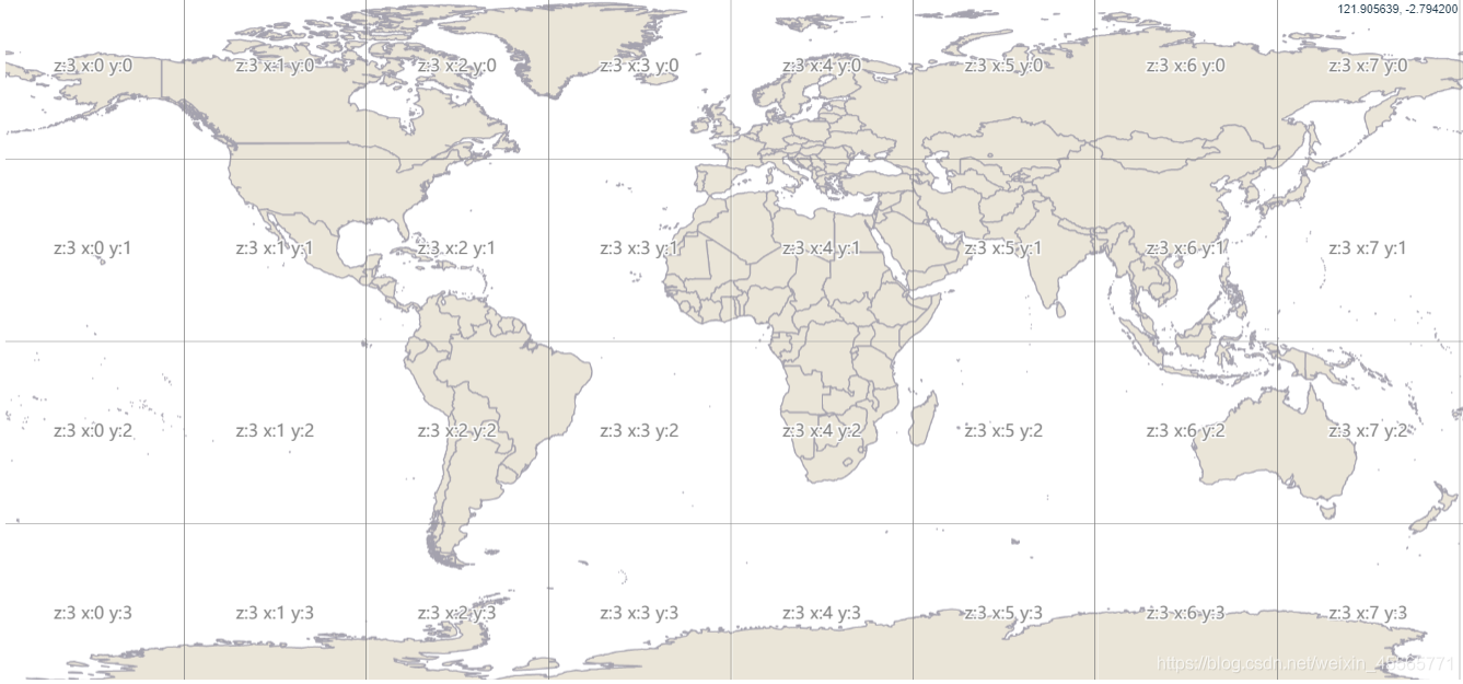
    let country = new Style({
      stroke: new Stroke({
        color: "rgba(164, 162, 174)",
        width: 2
      }),
      fill: new Fill({
        color: "rgba(233, 229, 216)"
      })
    });

    let vector4326 = new VectorTileLayer({
      // 矢量切片的数据源
      source: new VectorTileSource({
        projection: "EPSG:4326",
        format: new MVT({
          idProperty: "iso_a3"
        }),
        tileGrid: createXYZ({
          extent: olProj.get("EPSG:4326").getExtent(),
          maxZoom: 22
        }),
        // 矢量切片服务地址
        tileUrlFunction: function(tileCoord) {
          const url =
            "https://ahocevar.com/geoserver/gwc/service/tms/1.0.0/" +
            "ne:ne_10m_admin_0_countries@EPSG%3A4326@pbf/" +
            (tileCoord[0] - 1) +
            "/" +
            tileCoord[1] +
            "/" +
            (Math.pow(2, tileCoord[0] - 1) - 1 - tileCoord[2]) +
            ".pbf";
          return url;
        }
      }),
      style: country
    });
    let map = new Map({
      target: "map",
      layers: [
        vector4326,
        // 加载瓦片网格图层
        // new TileLayer({
        //   //瓦片网格数据源
        //   source: new TileDebug({
        //     //获取瓦片网格信息
        //     // tileGrid: vector4326.getSource().getTileGrid()
        //   })
        // })
      ],
      controls: [
        new MousePosition({
          coordinateFormat: createStringXY(6) // 鼠标位置
        })
      ],
      view: new View({
        projection: "EPSG:4326", // pbf4326格式需要使用4326坐标系
        center: [114.1564839, 24.61548857],
        zoom: 2
      })
    });
效果图如下:
如果你已经解决了该问题, 非常希望你能够分享一下解决方案, 写成博客, 将相关链接放在评论区, 以帮助更多的人 ^-^